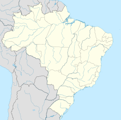
The Araguainha crater or Araguainha dome is an impact crater on the border of Mato Grosso and Goiás states, Brazil, between the villages of Araguainha and Ponte Branca.[1] With a diameter of 40 kilometres (25 mi), it is the largest known impact crater in South America.
| Araguainha crater | |
|---|---|
| Araguainha dome | |
 Landsat image of the Araguainha crater (May 2020) | |
| Impact crater/structure | |
| Confidence | Confirmed |
| Diameter | 40 km (25 mi) |
| Age | 254.7 ± 2.5 Ma Permian–Triassic boundary |
| Exposed | Yes |
| Drilled | No |
| Location | |
| Location | Paraná Basin |
| Coordinates | 16°48′S 52°59′W / 16.800°S 52.983°W |
| Country | Brazil |
| State | Goiás, Mato Grosso |
| Municipality | Araguainha & Ponte Branca |
The crater has most recently been dated to 254.7 ± 2.5 million years ago, when the region was probably a shallow sea. The margins of error of this date overlap the time of the Permian–Triassic extinction event, one of the largest mass extinction events in Earth's history.[2][3] The impact punched through Paleozoic sedimentary units belonging to the Paraná Basin formations, and exposed the underlying Ordovician granite basement rocks. It is estimated that the crater was initially 24 kilometres (15 mi) wide and 2.4 kilometres (1.5 mi) deep, which then widened to 40 kilometres (25 mi) as its walls subsided inwards.
Description
edit

Araguainha is a complex crater with annular and radial faults, exposed to the surface and eroded, cut through by the Araguaia River. The crater has an uplifted central core, shaped like an elliptical basin, consisting of exposed basement granite. Surrounding this core is a ring of shocked granite and overlying breccias; then another ring of ridges and mountains, 6.5 kilometres (4.0 mi) in diameter and up to 150 m (490 ft) high, consisting of folded and steeply tilted Devonian sandstones. This central region is surrounded by an annular depression floored by rocks from Devonian and Carboniferous sandstone formations. The outer rim of the crater consists of remnants of semi-circular grabens in highly deformed Permo-Carboniferous sediments. Evidences of impact origin include shatter cones, impact breccias, and shocked quartz.[4]
Access and conservation
editThe Araguainha Dome can be reached by car from Goiânia or from Cuiabá. An unpaved state road, between Ponte Branca and Araguainha, cuts across the central uplift, as does the Araguaia River. As of 1999, the local residents were not yet aware of the dome's nature and scientific importance.[4]
Dating and interpretation
editThe earliest report on the Araguainha structure was published by Northfleet et al. (1969),[5] who interpreted it as an uplift of the Phanerozoic sediments caused by a Cretaceous syenite intrusion. A geological reconnaissance survey by Silveira Filho and Ribeiro (1971)[6] noted the occurrence of lavas, breccias, and tuffs around the central core and deduced that Araguainha was a crypto-volcanic structure. Dietz and French (1973)[7] reported the occurrence of impact breccias and shocked quartz, and recognized the structure as an impact crater. A detailed study of the crater by Crósta et al. (1981)[8] and Crósta (1982)[9] reported further petrological and mineralogical evidence of the impact. Further geomorphologic evidence was published by Theilen-Willige (1981).[10] A magnetic survey was conducted by Fischer and Masero (1994).[11]
Dome formation was first dated (at 243 ± 19 million years ago, with Rb-Sr method) by Deutsch et al. (1992).[12] Engelhardt et al. (1992)[13] published a detailed study of the uplifted core and a revised date of about 246 million years ago, later revised to about 244 million years ago. Most recently it was dated by Tohver et al. (2012)[14] at 254.7 ± 2.5 million years ago.
Effects
editRecent dating by Tohver et al. (2012),[14] to 254.7 ± 2.5 million years ago, places the impact at dates overlapping estimates for the Permo-Triassic boundary.[14] and the Permian–Triassic extinction event.
Much of the local rock was oil shale. The estimated energy released by the Araguainha impact is insufficient to be a direct cause of the global mass extinction, but the colossal local earth rifting would have released huge amounts of oil and gas from the shattered rock. The resulting sudden global warming might have precipitated the Permian–Triassic extinction.[15]
References
editExternal links
edit- "Araguainha". Earth Impact Database.
- "Satellite image of the Araguainha region". Google Maps.
- "Araguainha dome". Archived from the original on 2013-06-25. Retrieved 2014-01-29.


