Békés (Hungarian: Békési járás) is a district in central-northern part of Békés County. Békés is also the name of the town where the district seat is found. The district is located in the Southern Great Plain Statistical Region.
Békés District Békési járás | |
|---|---|
 Coat of arms | |
 | |
| Coordinates: 46°46′N 21°08′E / 46.77°N 21.13°E | |
| Country | |
| County | Békés |
| District seat | Békés (town) |
| Area | |
| • Total | 525.24 km2 (202.80 sq mi) |
| • Rank | 7th in Békés |
| Population (2011 census) | |
| • Total | 37,409 |
| • Rank | 5th in Békés |
| • Density | 71/km2 (180/sq mi) |
Geography
editBékés District borders with Szeghalom District to the north, Sarkad District to the east, Békéscsaba District to the south, Szarvas District and Gyomaendrőd District to the west. The number of the inhabited places in Békés District is 7.
Municipalities
editThe district has 2 towns and 5 villages.(ordered by population, as of 1 January 2012)[1]
- Békés (19,763) – district seat
- Bélmegyer (981)
- Kamut (991)
- Köröstarcsa (2,477)
- Mezőberény (10,896)
- Murony (1,228)
- Tarhos (915)
The bolded municipalities are cities.
Demographics
editReligion in Békés District (2011 census)
In 2011, it had a population of 37,409 and the population density was 71/km².
| Year | County population[2] | Change |
|---|---|---|
| 2011 | 37,409 | n/a |
Ethnicity
editBesides the Hungarian majority, the main minorities are the Roma (approx. 2,000), German and Slovak (450), Romanian (100).
Total population (2011 census): 37,409
Ethnic groups (2011 census):[3] Identified themselves: 36,283 persons:
- Hungarians: 32,978 (90.89%)
- Gypsies: 2,102 (5.78%)
- Germans: 461 (1.27%)
- Slovaks: 448 (1.23%)
- Others and indefinable: 294 (0.81%)
Approx. 1,000 persons in Békés District did not declare their ethnic group at the 2011 census.
Religion
editReligious adherence in the county according to 2011 census:[4]
- Reformed – 9,393;
- Catholic – 3,367 (Roman Catholic – 3,321; Greek Catholic – 46);
- Evangelical – 1,638;
- other religions – 1,270;
- Non-religious – 13,812;
- Atheism – 326;
- Undeclared – 7,603.
Gallery
edit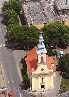 Békés, the district seat
 Kettős-Körös river near Mezőberény
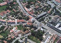 Aerial view of Mezőberény
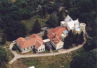 Wenckheim Mansion in Bélmegyer


See also
editReferences
edit- ^ A KSH 2012. évi helységnévkönyve
- ^ népesség.com, "Békési járás népessége"
- ^ 4.1.6.1 A népesség nemzetiség szerint, 2011, (in Hungarian) [1]
- ^ 4.1.7.1 A népesség vallás, felekezet szerint, 2011, (in Hungarian) [2]
External links
edit | This Békés County location article is a stub. You can help Wikipedia by expanding it. |