
Size of this PNG preview of this SVG file: 521 × 599 pixels. Other resolutions: 209 × 240 pixels | 417 × 480 pixels | 667 × 768 pixels | 890 × 1,024 pixels | 1,780 × 2,048 pixels | 916 × 1,054 pixels.
Original file (SVG file, nominally 916 × 1,054 pixels, file size: 151 KB)
| This is a file from the Wikimedia Commons. Information from its description page there is shown below. Commons is a freely licensed media file repository. You can help. |
Summary
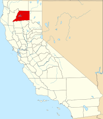
| Description | English: This is a locator map showing Shasta County in California. For more information, see Commons:United States county locator maps. |
| Date | |
| Source | Own work: English: The maps use data from nationalatlas.gov, specifically countyp020.tar.gz on the Raw Data Download page. The maps also use state outline data from statesp020.tar.gz. The Florida maps use hydrogm020.tar.gz to display Lake Okeechobee. |
| Author | David Benbennick |
Licensing
| I, the copyright holder of this work, release this work into the public domain. This applies worldwide. In some countries this may not be legally possible; if so: I grant anyone the right to use this work for any purpose, without any conditions, unless such conditions are required by law. |
File history
Click on a date/time to view the file as it appeared at that time.
| Date/Time | Thumbnail | Dimensions | User | Comment | |
|---|---|---|---|---|---|
| current | 23:03, 25 June 2024 | | 916 × 1,054 (151 KB) | Nux | uniform colors with good contrast |
| 10:27, 12 February 2006 |  | 9,164 × 10,536 (229 KB) | David Benbennick | {{subst:User:Dbenbenn/clm|county=Shasta County|state=California}} |
File usage
The following pages on the English Wikipedia use this file (pages on other projects are not listed):
- Anderson, California
- Beegum, California
- Bella Vista, California
- Big Bend, California
- Big Bend Rancheria
- Burney, California
- Cassel, California
- Castella, California
- Centerville, Shasta County, California
- Cottonwood, California
- Delta, California
- Delta Consolidated Mining Company
- Enterprise, Shasta County, California
- Fall River Mills, California
- French Gulch, California
- Gas Point, California
- Happy Valley, Shasta County, California
- Hat Creek, California
- Horsetown, California
- Igo, California
- Ingot, California
- Johnson Park, California
- Jones Valley, California
- Kennett, California
- Keswick, California
- Lakehead, California
- Lakehead-Lakeshore, California
- List of counties in California
- McArthur, California
- Millville, California
- Montgomery Creek, California
- Mountain Gate, California
- National Register of Historic Places listings in Shasta County, California
- O'Brien, California
- Oak Run, California
- Old Station, California
- Ono, California
- Palo Cedro, California
- Piety Hill, California
- Platina, California
- Portuguese Flat, California
- Reading's Bar
- Redding, California
- Redding Rancheria
- Round Mountain, California
- Shasta, California
- Shasta County, California
- Shasta Lake, California
- Shingletown, California
- Southern Hotel & Stage Station
- Tower House Historic District
- Viola, California
- Whiskeytown, California
- Whitmore, California
- User:AridCeption/sandbox
- User:CactusJack/California watchlist
- User:Darkest tree/sandbox/List of counties in California
- User:Magnolia677/Tunnel Inn, California
- User:Nyttend/County templates/CA/3
- Template:Shasta County, California
- Category:Populated places in Shasta County, California
- Category:Wikipedia requested photographs in Shasta County, California
Global file usage
The following other wikis use this file:
- Usage on ar.wikipedia.org
- Usage on az.wikipedia.org
- Usage on ban.wikipedia.org
- Usage on be.wikipedia.org
- Usage on bg.wikipedia.org
- Usage on bpy.wikipedia.org
- Usage on ca.wikipedia.org
- Anderson (Califòrnia)
- Big Bend (Comtat de Shasta)
- Burney (Califòrnia)
- Cottonwood (Califòrnia)
- Fall River Mills
- French Gulch
- Lakehead-Lakeshore
- McArthur (Califòrnia)
- Millville (Califòrnia)
- Montgomery Creek
- Palo Cedro
- Redding (Califòrnia)
- Round Mountain (Califòrnia)
- Shasta Lake
- Shingletown
- Llista de comtats de Califòrnia
- Ranxeria Redding
- Plantilla:Comtat de Shasta
- Ranxeria Big Bend
- Ranxeria Montgomery Creek
- Ranxeria Roaring Creek
- Usage on ceb.wikipedia.org
- Usage on ce.wikipedia.org
- Usage on cs.wikipedia.org
- Usage on cy.wikipedia.org
- Usage on da.wikipedia.org
- Usage on de.wikipedia.org
View more global usage of this file.
Metadata
🔥 Top keywords: Akademia e Shkencave e RPS te ShqiperiseAlexandria Ocasio-CortezBilderberg GroupCristiano RonaldoDong XiaowanMinecraftOperation GladioPrimal cutRiot FestStrictly Come Dancing (series 7)Main PageSpecial:SearchUEFA Euro 2024Wikipedia:Featured picturesJulian AssangeShifty ShellshockFlorida PanthersList of Stanley Cup championsUEFA European ChampionshipPaul MauriceConnor McDavidMatthew TkachukCleopatraDeaths in 2024House of the Dragon2024 ICC Men's T20 World CupKeith Tkachuk2024 Copa AméricaCrazy TownStella AssangeChelsea ManningYouTubeElon MuskRoberto LuongoAnna Hall (athlete)ICC Men's T20 World CupMckenna GraceStanley CupJJ RedickConn Smythe Trophy.xxxInside Out 2Danny MakkelieZaheer IqbalAfghanistan national cricket teamMoney in the Bank (2024)Gordon Todd SkinnerProject 2025Dr Disrespect