Fichier:St George Island Fl.png
Pas de plus haute résolution disponible.
St_George_Island_Fl.png (487 × 372 pixels, taille du fichier : 36 kio, type MIME : image/png)
Ce fichier et sa description proviennent de Wikimedia Commons.
Transwiki approved by: w:en:User:Dmcdevit
This image was copied from wikipedia:en. The original description was:
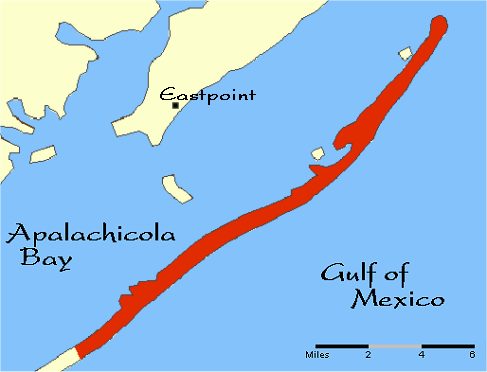
Cette carte a été obtenue d'une édition du National Atlas of the United States . Comme presque toutes les œuvres du gouvernement fédéral des États-Unis d'Amérique, les travaux du National Atlas sont placés dans le domaine public.Version en ligne : NationalAtlas.gov | Édition imprimée de 1970 : Library of Congress, Perry-Castañeda Library |
I don’t know where to put a talk issue: why is only part of the island red? What does the red signify?
Journal des téléversements d’origine
| date/time | username | resolution | size | edit summary |
|---|---|---|---|---|
| 16:17, 15 May 2006 | w:en:User:Noles1984 | 487×372 | 36 KB | {{PD-USGov-Atlas}} <a href="https://www.how.com.vn/wiki/fr/Category:Florida_maps" title="Category:Florida maps">Category:Florida maps</a> |
Image description page history
| link | date/time | username | edit summary |
|---|---|---|---|
| http://en.wikipedia.org/w/index.php?title=Image:St_George_Island_Fl.png&redirect=no&oldid=53336011 | 07:27, 10 September 2007 | w:en:User:Dmcdevit | |
| http://en.wikipedia.org/w/index.php?title=Image:St_George_Island_Fl.png&redirect=no&oldid=53336011 | 16:17, 15 May 2006 | w:en:User:Noles1984 | ({{PD-USGov-Atlas}} <a href="https://www.how.com.vn/wiki/fr/Category:Florida_maps" title="Category:Florida maps">Category:Florida maps</a>) |
Historique du fichier
Cliquer sur une date et heure pour voir le fichier tel qu'il était à ce moment-là.
| Date et heure | Vignette | Dimensions | Utilisateur | Commentaire | |
|---|---|---|---|---|---|
| actuel | 10 septembre 2007 à 18:39 | | 487 × 372 (36 kio) | BetacommandBot | Transwiki approved by: w:en:User:Dmcdevit This image was copied from wikipedia:en. The original description was: {{PD-USGov-Atlas}} w:en:Category:Florida maps === File history === {| class=wikitable ! date/time || username || resolution || siz |
Utilisation du fichier
La page suivante utilise ce fichier :
Usage global du fichier
Les autres wikis suivants utilisent ce fichier :
- Utilisation sur de.wikipedia.org
- Utilisation sur en.wikipedia.org
- Utilisation sur zh.wikipedia.org
🔥 Top keywords: Cookie (informatique)Wikipédia:Accueil principalSpécial:RechercheKeir StarmerCristiano RonaldoJordan BardellaPepe (football)Liste de sondages sur les élections législatives françaises de 2024William SalibaMike MaignanLamine YamalKylian MbappéChampionnat d'Europe de football 2024Robin Le NormandN'Golo KantéParti travailliste (Royaume-Uni)Championnat d'Europe de footballÉlections générales britanniques de 2024Rishi SunakRoberto Martínez (football)Antoine GriezmannBradley BarcolaAymeric LaporteDani OlmoEduardo CamavingaMarine TondelierJules KoundéDidier DeschampsGabriel AttalNico WilliamsMarcus ThuramClémence GuettéChampionnat d'Europe de football 2020Le Comte de Monte-CristoThomas Müller (football)Théo HernandezÉlections législatives françaises de 2024Rafael LeãoChristophe Dugarry