Crawford County, Kansas
county in Kansas, United States
Crawford County (county code CR) is a county in Southeast Kansas. In 2020 census, 38,972 people lived there.[1] Its county seat is Girard.[2] Its biggest city is Pittsburg. The county was named after Samuel J. Crawford,[3] Governor of Kansas.
Crawford County | |
|---|---|
 Crawford County Courthouse in Girard (2012) | |
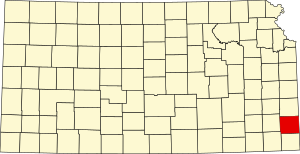
 Location within the U.S. state of Kansas | |
 Kansas's location within the U.S. | |
| Coordinates: 37°31′N 94°51′W / 37.517°N 94.850°W | |
| Country | |
| State | |
| Founded | February 13, 1867 |
| Named for | Samuel J. Crawford |
| Seat | Girard |
| Largest city | Pittsburg |
| Area | |
| • Total | 595 sq mi (1,540 km2) |
| • Land | 590 sq mi (1,500 km2) |
| • Water | 5.3 sq mi (14 km2) 0.9% |
| Population | |
| • Total | 38,972 |
| • Density | 66.1/sq mi (25.5/km2) |
| Time zone | UTC−6 (Central) |
| • Summer (DST) | UTC−5 (CDT) |
| Area code | 620 |
| Congressional district | 2nd |
| Website | CrawfordCountyKansas.org |
It is in the Osage Cuestas and Cherokee Lowlands. It is halfway between Kansas City, Missouri and Tulsa, Oklahoma. Pittsburg State University is located in Crawford County.
Geography
changeThe U.S. Census Bureau says that the county has a total area of 595 square miles (1,540 km2). Of that, 590 square miles (1,500 km2) is land and 5.3 square miles (14 km2) (0.9%) is water.[4]
People
change| Historical population | |||
|---|---|---|---|
| Census | Pop. | %± | |
| 1870 | 8,160 | — | |
| 1880 | 16,851 | 106.5% | |
| 1890 | 30,286 | 79.7% | |
| 1900 | 38,809 | 28.1% | |
| 1910 | 51,178 | 31.9% | |
| 1920 | 61,800 | 20.8% | |
| 1930 | 49,329 | −20.2% | |
| 1940 | 44,191 | −10.4% | |
| 1950 | 40,231 | −9.0% | |
| 1960 | 37,032 | −8.0% | |
| 1970 | 37,850 | 2.2% | |
| 1980 | 37,916 | 0.2% | |
| 1990 | 35,568 | −6.2% | |
| 2000 | 38,242 | 7.5% | |
| 2010 | 39,134 | 2.3% | |
| 2020 | 38,972 | −0.4% | |
| U.S. Decennial Census[5] 1790-1960[6] 1900-1990[7] 1990-2000[8] 2010-2020[1] | |||

The Pittsburg Micropolitan Statistical Area includes all of Crawford County.
Government
changePresidential elections
changePresidential election results
| Year | Republican | Democratic | Third Parties |
|---|---|---|---|
| 2020 | 60.1% 10,045 | 37.0% 6,179 | 3.0% 494 |
| 2016 | 57.2% 8,624 | 34.5% 5,199 | 8.3% 1,251 |
| 2012 | 51.3% 7,708 | 45.4% 6,826 | 3.4% 506 |
| 2008 | 48.1% 7,735 | 49.5% 7,957 | 2.4% 383 |
| 2004 | 52.2% 8,626 | 46.1% 7,617 | 1.7% 284 |
| 2000 | 47.6% 7,160 | 47.1% 7,076 | 5.3% 798 |
| 1996 | 40.6% 6,447 | 47.3% 7,504 | 12.2% 1,929 |
| 1992 | 33.0% 5,468 | 44.4% 7,366 | 22.7% 3,757 |
| 1988 | 46.7% 6,940 | 52.4% 7,783 | 0.9% 127 |
| 1984 | 58.1% 9,518 | 41.0% 6,722 | 0.9% 141 |
| 1980 | 47.8% 8,058 | 45.4% 7,658 | 6.8% 1,139 |
| 1976 | 43.8% 7,225 | 54.7% 9,021 | 1.6% 258 |
| 1972 | 58.0% 9,652 | 40.2% 6,683 | 1.8% 302 |
| 1968 | 45.3% 7,344 | 44.4% 7,191 | 10.4% 1,678 |
| 1964 | 37.8% 6,286 | 61.8% 10,282 | 0.5% 76 |
| 1960 | 52.8% 9,383 | 46.8% 8,325 | 0.4% 69 |
| 1956 | 54.9% 9,578 | 44.7% 7,799 | 0.3% 60 |
| 1952 | 55.8% 10,646 | 43.8% 8,349 | 0.4% 79 |
| 1948 | 46.2% 8,229 | 50.6% 9,005 | 3.3% 581 |
| 1944 | 52.1% 9,017 | 47.4% 8,211 | 0.5% 83 |
| 1940 | 47.7% 10,143 | 51.7% 11,002 | 0.6% 130 |
| 1936 | 39.7% 8,596 | 60.0% 12,974 | 0.3% 66 |
| 1932 | 37.4% 6,884 | 59.8% 10,994 | 2.8% 523 |
| 1928 | 62.3% 10,992 | 36.0% 6,351 | 1.7% 299 |
| 1924 | 50.3% 9,063 | 19.1% 3,433 | 30.6% 5,509 |
| 1920 | 54.7% 7,957 | 36.8% 5,362 | 8.5% 1,234 |
| 1916 | 38.1% 7,067 | 43.5% 8,064 | 18.4% 3,408 |
| 1912 | 25.2% 2,676 | 26.1% 2,781 | 48.7% 5,180[a] |
| 1908 | 46.6% 5,152 | 38.2% 4,230 | 15.2% 1,686 |
| 1904 | 58.4% 5,910 | 20.3% 2,057 | 21.4% 2,162 |
| 1900 | 48.7% 4,722 | 49.7% 4,824 | 1.6% 158 |
| 1896 | 44.4% 3,868 | 54.6% 4,757 | 1.0% 87 |
| 1892 | 41.9% 3,064 | 58.1% 4,250 | |
| 1888 | 48.5% 3,156 | 28.8% 1,875 | 22.8% 1,482 |
Communities
change
Cities
changeReferences
change- Notes
- ↑ This includes 3,753 votes for Socialist Eugene V. Debs and 1,427 votes for Progressive Theodore Roosevelt.
More reading
change- Plat Book of Crawford County, Kansas; North West Publishing Co; 54 pages; 1906.
Other websites
change
Wikimedia Commons has media related to Crawford County, Kansas.
- County
- Crawford County - Official
- Crawford County - Directory of Public Officials
- Crawford County - Convention and Visitors Bureau
- Historical
- Maps
🔥 Top keywords: Main PageList of people who have walked on the MoonSpecial:SearchInside Out (2015 movie)Supreme Court of the United StatesHurricane GilbertWikipedia:AboutBad Boys for LifeUnited States presidential line of successionHelp:ContentsList of political parties in the United KingdomHelp:IntroductionJulyList of UEFA European Championship finalsList of U.S. statesXXXTentacionList of U.S. states and territories by time zoneBlack24-hour clockTwenty-fifth Amendment to the United States ConstitutionUnited StatesWikipedia:Simple talkAdolf Hitler UunonaList of prime ministers of the United KingdomMeerkatHelp:Authority controlTwenty-second Amendment to the United States ConstitutionSpecial:RecentChangesComputer coolingDune: Part TwoQueen (band)Wikipedia:Administrators' noticeboardList of countries by continents0KalkiBismillahir Rahmanir RaheemTurkey at the UEFA European ChampionshipCristiano RonaldoKnights of the Round Table