Leavenworth County, Kansas
county in Kansas, United States
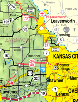
Leavenworth County (county code LV) is a county in the U.S. state of Kansas. In 2020, 81,881 people lived there.[1] Its county seat is Leavenworth. Leavenworth is also the biggest city in Leavenworth County.[2]
Leavenworth County | |
|---|---|
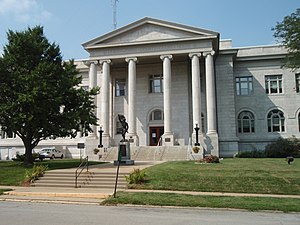
 Leavenworth County Courthouse in Leavenworth | |
 Location within the U.S. state of Kansas | |
 Kansas's location within the U.S. | |
| Coordinates: 39°16′07″N 95°07′32″W / 39.2686°N 95.1256°W | |
| Country | |
| State | |
| Founded | August 25, 1855 |
| Named for | Henry Leavenworth |
| Seat | Leavenworth |
| Largest city | Leavenworth |
| Area | |
| • Total | 469 sq mi (1,210 km2) |
| • Land | 463 sq mi (1,200 km2) |
| • Water | 6.1 sq mi (16 km2) 1.3% |
| Population | |
| • Total | 81,881 |
| • Density | 176.8/sq mi (68.3/km2) |
| Time zone | UTC−6 (Central) |
| • Summer (DST) | UTC−5 (CDT) |
| Congressional district | 2nd |
| Website | www |
Geography
changeThe U.S. Census Bureau says that the county has a total area of 469 square miles (1,210 km2). Of that, 463 square miles (1,200 km2) is land and 6.1 square miles (16 km2) (1.3%) is water.[3] It is the fifth-smallest county in Kansas.
People
change| Historical population | |||
|---|---|---|---|
| Census | Pop. | %± | |
| 1860 | 12,606 | — | |
| 1870 | 32,444 | 157.4% | |
| 1880 | 32,355 | −0.3% | |
| 1890 | 38,485 | 18.9% | |
| 1900 | 40,940 | 6.4% | |
| 1910 | 41,207 | 0.7% | |
| 1920 | 38,402 | −6.8% | |
| 1930 | 42,673 | 11.1% | |
| 1940 | 41,112 | −3.7% | |
| 1950 | 42,361 | 3.0% | |
| 1960 | 48,524 | 14.5% | |
| 1970 | 53,340 | 9.9% | |
| 1980 | 54,809 | 2.8% | |
| 1990 | 64,371 | 17.4% | |
| 2000 | 68,691 | 6.7% | |
| 2010 | 76,227 | 11.0% | |
| 2020 | 81,881 | 7.4% | |
| U.S. Decennial Census[4] 1790-1960[5] 1900-1990[6] 1990-2000[7] 2010-2020[1] | |||

The county is a part of the Kansas City, MO-KS Metropolitan Statistical Area.
Government
changePresidential elections
changePresidential Elections Results
| Year | Republican | Democratic | Third Parties |
|---|---|---|---|
| 2020 | 59.2% 21,610 | 38.1% 13,886 | 2.7% 994 |
| 2016 | 57.6% 17,638 | 33.3% 10,209 | 9.1% 2,792 |
| 2012 | 58.7% 17,059 | 39.1% 11,357 | 2.3% 669 |
| 2008 | 54.9% 16,791 | 43.3% 13,255 | 1.8% 545 |
| 2004 | 58.4% 15,949 | 40.4% 11,039 | 1.3% 343 |
| 2000 | 54.1% 12,583 | 41.8% 9,733 | 4.1% 955 |
| 1996 | 47.9% 10,778 | 40.4% 9,098 | 11.7% 2,624 |
| 1992 | 33.4% 7,738 | 34.9% 8,077 | 31.8% 7,357 |
| 1988 | 52.5% 9,913 | 46.6% 8,797 | 0.9% 160 |
| 1984 | 62.3% 11,194 | 36.8% 6,604 | 1.0% 172 |
| 1980 | 55.0% 9,157 | 38.2% 6,354 | 6.9% 1,145 |
| 1976 | 50.1% 8,407 | 47.8% 8,022 | 2.1% 349 |
| 1972 | 67.7% 10,762 | 29.7% 4,727 | 2.6% 408 |
| 1968 | 48.4% 7,081 | 37.9% 5,546 | 13.8% 2,018 |
| 1964 | 42.4% 5,544 | 57.1% 7,479 | 0.5% 66 |
| 1960 | 53.1% 7,870 | 46.7% 6,926 | 0.2% 36 |
| 1956 | 61.6% 8,826 | 38.2% 5,480 | 0.2% 33 |
| 1952 | 61.2% 9,046 | 38.5% 5,698 | 0.3% 39 |
| 1948 | 48.6% 6,474 | 50.6% 6,740 | 0.8% 103 |
| 1944 | 58.6% 7,282 | 41.0% 5,097 | 0.5% 59 |
| 1940 | 58.3% 8,503 | 41.5% 6,053 | 0.3% 42 |
| 1936 | 51.4% 8,532 | 48.2% 7,996 | 0.4% 73 |
| 1932 | 40.2% 6,484 | 59.0% 9,507 | 0.8% 123 |
| 1928 | 56.3% 8,472 | 43.4% 6,539 | 0.3% 45 |
| 1924 | 68.1% 9,429 | 21.5% 2,982 | 10.4% 1,445 |
| 1920 | 65.1% 6,846 | 32.4% 3,409 | 2.6% 269 |
| 1916 | 45.5% 5,536 | 49.3% 6,002 | 5.3% 640 |
| 1912 | 33.1% 2,562 | 40.0% 3,099 | 27.0% 2,092 |
| 1908 | 53.9% 4,846 | 42.4% 3,818 | 3.7% 332 |
| 1904 | 64.2% 5,771 | 30.9% 2,775 | 5.0% 450 |
| 1900 | 49.8% 4,162 | 49.2% 4,109 | 1.0% 80 |
| 1896 | 45.8% 4,004 | 53.4% 4,665 | 0.8% 68 |
| 1892 | 47.0% 3,471 | 53.0% 3,921 | |
| 1888 | 45.5% 3,272 | 48.9% 3,516 | 5.7% 406 |
Communities
change
Cities
change- Basehor
- Bonner Springs (part)
- De Soto (part)
- Easton
- Kansas City (part)
- Lansing
- Leavenworth
- Linwood
- Tonganoxie
References
change- ↑ 1.0 1.1 1.2 "QuickFacts: Leavenworth County, Kansas". United States Census Bureau. Retrieved October 1, 2023.
- ↑ "Find a County". National Association of Counties. Retrieved 2011-06-07.
- ↑ "US Gazetteer files: 2010, 2000, and 1990". United States Census Bureau. 2011-02-12. Retrieved 2011-04-23.
- ↑ "U.S. Decennial Census". United States Census Bureau. Retrieved July 26, 2014.
- ↑ "Historical Census Browser". University of Virginia Library. Archived from the original on August 11, 2012. Retrieved July 26, 2014.
- ↑ "Population of Counties by Decennial Census: 1900 to 1990". United States Census Bureau. Retrieved July 26, 2014.
- ↑ "Census 2000 PHC-T-4. Ranking Tables for Counties: 1990 and 2000" (PDF). United States Census Bureau. Retrieved July 26, 2014.
- ↑ "Dave Leip's Atlas of U.S. Presidential Elections".
More reading
change- History of Leavenworth County Kansas; Jesse Hall and LeRoy Hand; Historical Publishing; 684 pages; 1921.
- Standard Atlas of Leavenworth County, Kansas; Geo. A. Ogle & Co; 42 pages; 1903.
- Atlas Map of Leavenworth County, Kansas; Missouri Publishing Co; 38 pages; 1878.
Other websites
change
Wikimedia Commons has media related to Leavenworth County, Kansas.

- County
- Official website

- Leavenworth County - Directory of Public Officials
- Leavenworth County - Development Corporation
- Maps
🔥 Top keywords: